The West Coast’s highest roads are closing in this exact order, and one of them could shut any day now
Every fall, three of the best drives on the West Coast quietly go on the clock, and almost nobody tracks the countdown until it’s already over. Winter doesn’t take out Sunrise, Crater Lake’s Rim Drive, and Yosemite’s high country all at once — it works through them one at a time, in a pretty consistent order.
Psst — we made you a West Coast Adventure Map. Nearly 1,900 of our favorite spots, already pinned, ready to load into Google Maps in two clicks — grab it here.
First out: Sunrise, Mount Rainier (Washington)
Sunrise sits at 6,400 feet, the highest point you can actually drive to anywhere in Mount Rainier National Park, and it’s also the first of these three roads to go. It typically closes for the season in mid-October or earlier, the moment the first heavy snowfall hits — some years it’s already shutting down overnight at the White River Campground junction by late September.
📍 GET THE ULTIMATE PNW MAP 🗺️
Get our curated list of the best adventures, things to do, and places to grab a brew loaded onto your maps with just two clicks!
✅ Waterfalls ✅ Hikes ✅ Viewpoints
✅ Craft breweries ✅ National Parks ✅ 1400+ Pins


If you make it up before then, Mount Fremont Lookout Trail is the move: 5.6 miles round trip with about 900 feet of climbing, passing Frozen Lake on the way to a 1930s-era fire lookout with a straight-on view of the Emmons Glacier. An America the Beautiful Pass covers the entrance fee, or you can pay at the gate.
Next: Rim Drive, Crater Lake (Oregon)
Crater Lake’s North Entrance Road and the full 33-mile Rim Drive close together, usually sometime between late October and the first few days of November, whenever the first real snow shows up. The West and South entrances off Highway 62 stay open all winter, so the lake itself never actually closes — you just lose the loop around it.

Garfield Peak Trail is the rim hike worth timing a visit around: about 3.4 miles round trip from Crater Lake Lodge, climbing roughly 1,100 feet to a full panorama over the caldera. Entrance runs $30 per vehicle for a 7-day summer pass ($20 in winter), or an America the Beautiful Pass if you’re hitting more than one park this year.
Last call: Tioga Road, Yosemite (California)
Tioga Road is the only way into Tuolumne Meadows, Yosemite’s high country at roughly 8,600 feet, and it’s typically the last of the three to close — most years sometime in the first half of November. It’s shut as early as mid-October in a bad year and hung on past Thanksgiving in a good one, and even the park can’t give you an exact date until a storm actually forces the call.
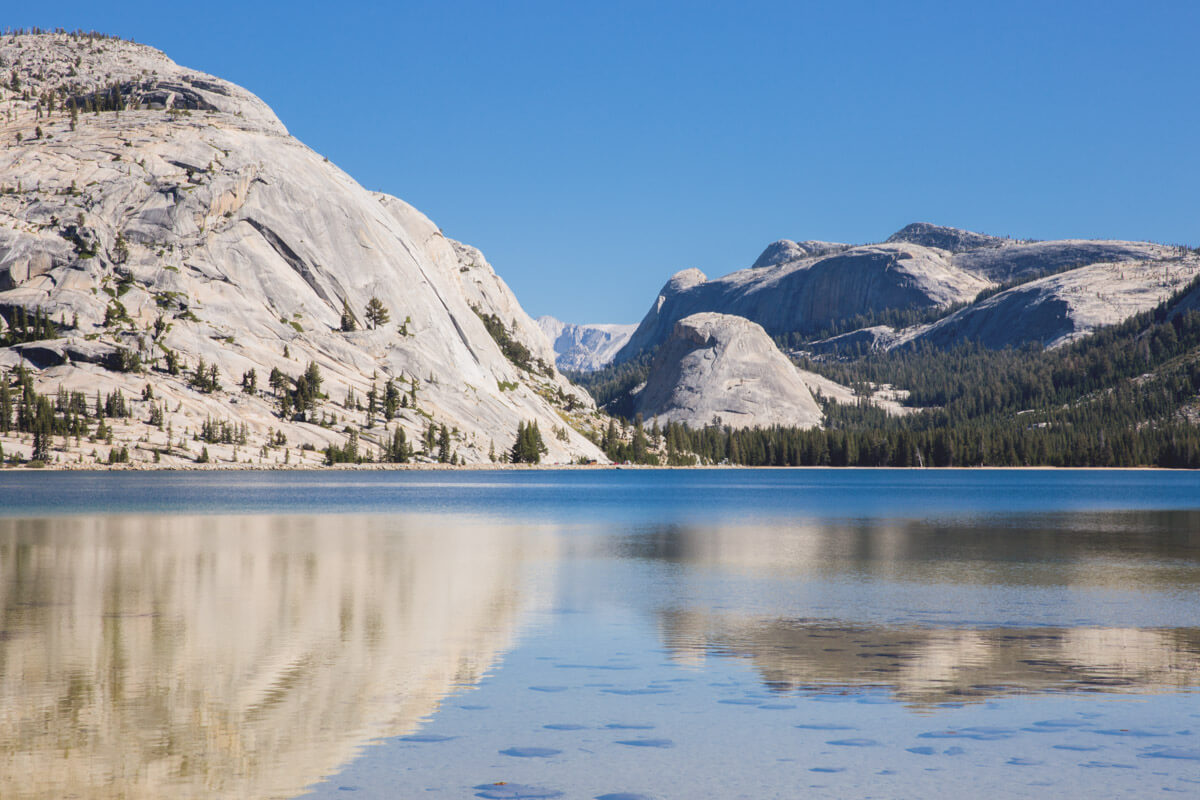
Lembert Dome is the payoff while the gate’s still open: a 3.7-mile loop with about 846 feet of climbing up a granite dome with a 360-degree view over the whole meadow. Yosemite’s entrance fee runs $35 for seven days, also covered by the America the Beautiful Pass.
Willing to push further into the high country before the gate drops? These 15 hikes in Yosemite are worth building a whole trip around, and Glacier Point Road nearby runs on almost the same countdown.
Same mountain range, same storm systems rolling down from the Gulf of Alaska, three completely different deadlines. Which one are you racing first?
Trip tips: grab a rental car to get out here, lock in your hotel before the last good rooms of the season disappear, or skip both and book a camper van instead.
Rules and fees change — always confirm current requirements before you go.