Most West Coast waterfalls thin out by August — these three never got the memo

By late summer, a lot of West Coast waterfalls are running on fumes. The snowmelt that fed them back in May is long gone, and what’s left is a trickle next to a sign promising something a lot bigger.
These three don’t have that problem. One’s held back by a dam, one’s fed by underground springs that couldn’t care less what the sky is doing, and one gets its water from a lake that hasn’t run dry in 3,000 years. Here’s where to find water that’s still moving in August.
Psst — we made you a West Coast Adventure Map. Nearly 1,900 of our favorite spots, already pinned, ready to load into Google Maps in two clicks — grab it here.
Snoqualmie Falls, Washington
Start with the one that basically can’t dry up. Snoqualmie Falls drops 268 feet over a granite cliff about 30 minutes east of Seattle, and the flow has been managed by a hydroelectric plant running since 1898 — so unlike a river fed purely by rain, there’s a floor under how low it can get.
📍 GET THE ULTIMATE PNW MAP 🗺️
Get our curated list of the best adventures, things to do, and places to grab a brew loaded onto your maps with just two clicks!
✅ Waterfalls ✅ Hikes ✅ Viewpoints
✅ Craft breweries ✅ National Parks ✅ 1400+ Pins


The walk is barely a workout: 1.4 miles round trip between the upper and lower viewing platforms, rated easy, about an hour if you’re not rushing. Parking and the viewing area are free, open dawn to dusk, no ticket booth to plan around.
Pick the lower platform if you only have time for one — that’s where you actually feel the spray, not just watch it from behind a railing.
Sahalie and Koosah Falls, Oregon
An hour east of Eugene on the McKenzie River, Sahalie and Koosah Falls don’t rely on rainfall at all. Both are fed by Clear Lake and an underground source called the Great Spring, which has been pushing cold water into the river for roughly 3,000 years, so the flow barely shifts between April and October.
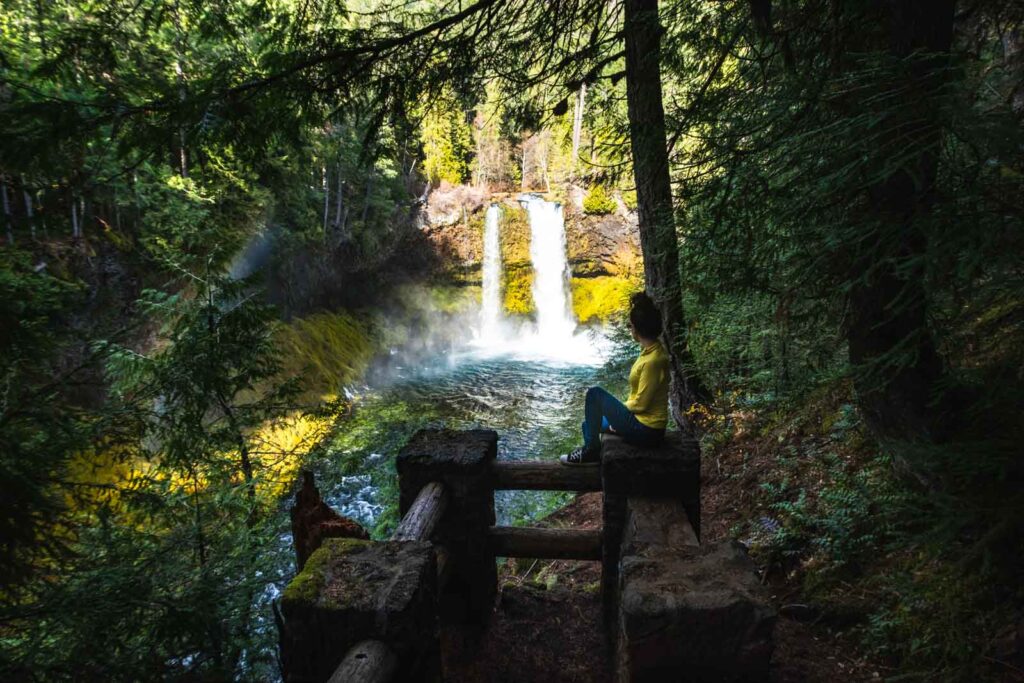
The Waterfalls Loop Trail connects both in a 2.5-mile loop with about 370 feet of climbing — easy to moderate, with close-up viewpoints of Sahalie’s roughly 70-foot drop and Koosah’s wider curtain a half mile downstream. Both sites also have parking right at the falls if you’d rather skip the walk.
There’s no day-use fee here, which is rare enough on the West Coast to be worth mentioning on its own.
Burney Falls, California
Burney Falls drops 129 feet in McArthur-Burney Falls Memorial State Park, and it doesn’t just spill over the top — a good chunk of it pours straight out of the rock face, fed by underground springs pushing out roughly 100 million gallons a day no matter what the rest of the state’s rivers are doing. Theodore Roosevelt reportedly called it the eighth wonder of the world.
A September visit here — usually one of the driest stretches of the year — found it just as loud as it probably is every other month. The loop trail down to the base is 1.1 miles with about 170 feet of elevation gain, mostly paved and easy enough for flip-flops. Full details on the hike are worth a look before you go.
Two things worth knowing first: it’s $10 per car to park, cash only, and if you’re going on a Friday, Saturday, Sunday, or holiday between mid-May and late September this year, you’ll need a parking reservation booked in advance through the park’s website. Walk-up parking on those days isn’t guaranteed.
Three states, three completely different reasons none of these are drying up on you — a dam, a spring, and a lake that’s been full since before Rome existed. Which one’s closest to your next trip?
Trip tips: grab a rental car to get between all three, lock in a hotel before the good rooms are gone, or skip both and book a camper van instead.
Rules and fees change — always confirm current requirements before you go.