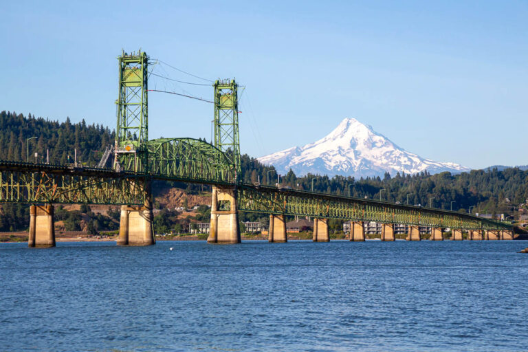
Hiking at Starvation Creek State Park, Oregon

Tucked into a small, tree-shaded turnout along I-84, Starvation Creek State Park might sound dramatic—but it’s actually one of the most approachable and versatile stops in the Columbia River Gorge.
We stopped at Starvation Creek a few times during our trips in the area. It’s a great underrated spot with few crowds compared to the rest of the Gorge.
Whether you’re looking for a short, paved stroll to multiple waterfalls, a longer paved bike path, or one of the most challenging day hikes in Oregon, this little stop delivers.
Table of Contents
- Starvation Creek Falls Intro:
- Trail #1: Historic Columbia River Highway Trail – Cabin Creek to Hole-in-the-Wall Falls
- Trail #2: Historic Columbia River Highway Trail – Wyeth to Starvation Creek
- Trail #3: Mount Defiance Trail and Starvation Ridge Loop
- Plan Your Visit
- Final Thoughts: A Little Bit of Everything
- More From Around The Gorge:
- MORE ON THE WEST COAST:
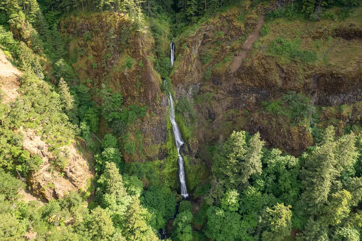
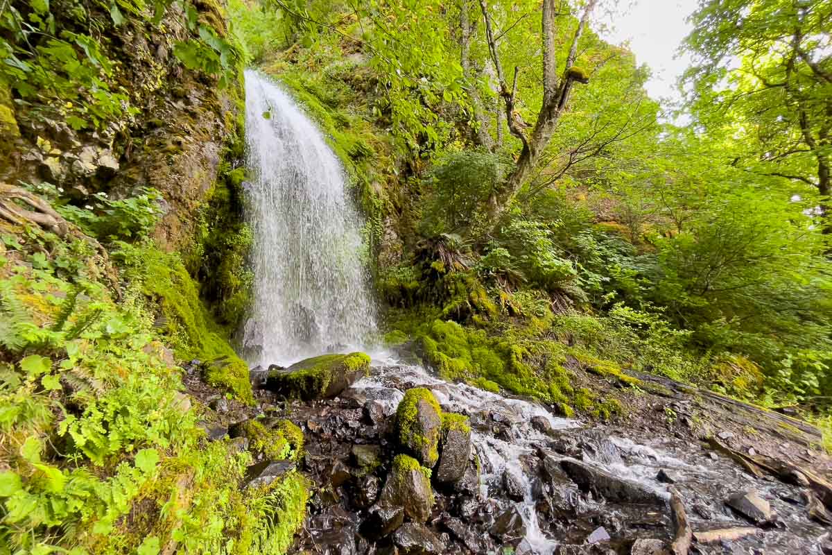
Starvation Creek Falls Intro:
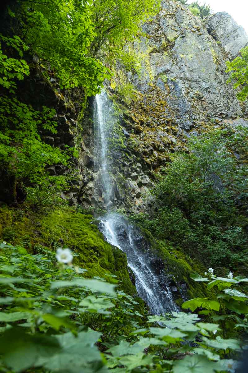
The main attraction? Starvation Creek Falls, which is quite literally steps from the parking lot.
📍 GET THE ULTIMATE PNW MAP 🗺️
Get our curated list of the best adventures, things to do, and places to grab a brew loaded onto your maps with just two clicks!
✅ Waterfalls ✅ Hikes ✅ Viewpoints
✅ Craft breweries ✅ National Parks ✅ 1400+ Pins

You’ll hear it as soon as you pull in—and then you’ll spot a beautiful, tall waterfall cascading down a mossy cliff, right next to a picnic table and creekside seating area. No hike required!
The small park has a few other picnic spots and shaded paths tucked along the edges of the trailhead.
Despite being close to the highway, the dense trees give it a peaceful, tucked-away feel. It’s a great place to stretch your legs, grab a snack, or base yourself for a full day of hiking.
Trail #1: Historic Columbia River Highway Trail – Cabin Creek to Hole-in-the-Wall Falls
Distance: 1.9 miles out-and-back
Difficulty: Easy
Elevation Gain: 216 ft
Surface: Mostly paved
This is the short and sweet option—and it’s surprisingly packed with scenic stops.
From Starvation Creek Falls, you’ll follow the paved path west, parallel to the historic highway. Yes, you’ll hear some traffic for a bit, but the trail is mostly shaded and still feels quiet.
Along the way, you’ll pass Cabin Creek Falls (a smaller cascade just off the path), then arrive at Hole-in-the-Wall Falls, which has a bridge and a picnic table nearby.
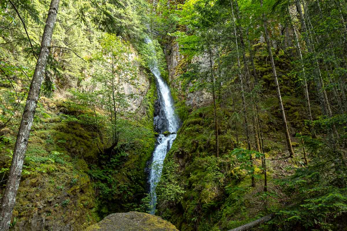
If you’re up for a short uphill detour, continue to Lancaster Falls—it’s steep, but brief, and it’s another waterfall spot!
I did this whole section recently, and it’s one of those easy walks that over-delivers. Four named waterfalls in less than two miles? That’s my kind of math!
READ MORE: 17+ Must-Visit Columbia River Gorge Waterfalls
📍 GET THE ULTIMATE PNW MAP 🗺️
Get our curated list of the best adventures, things to do, and places to grab a brew loaded onto your maps with just two clicks!
✅ Waterfalls ✅ Hikes ✅ Viewpoints
✅ Craft breweries ✅ National Parks ✅ 1400+ Pins
Trail #2: Historic Columbia River Highway Trail – Wyeth to Starvation Creek
Distance: 8.9 miles out-and-back
Difficulty: Moderate
Surface: Fully paved
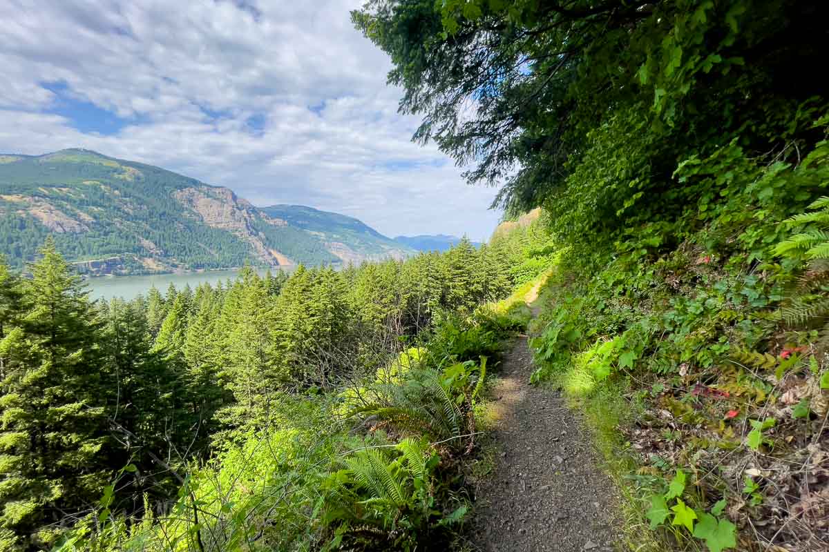
This longer paved trail connects Starvation Creek to Wyeth Trailhead, following the old Historic Columbia River Highway.
It’s part of a larger Gorge-wide project to convert decommissioned roadways into pedestrian and bike-friendly paths.
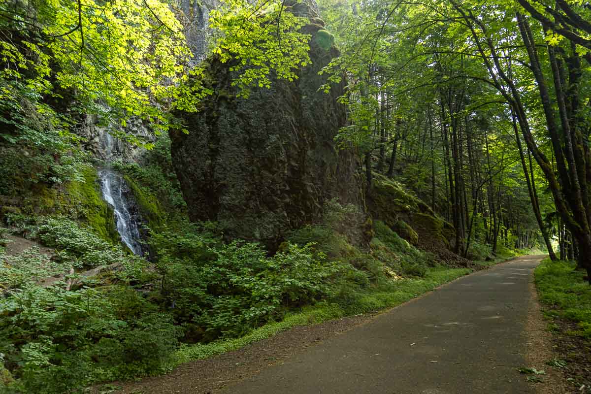
It’s popular with cyclists and runners, and though the exposure means more wind and sun, you’ll still get a few waterfall glimpses, especially near the Starvation end.
This is a great in-between option—more effort than the short waterfall trail, but still fully paved and accessible. Bring water and sun protection—shade is patchy.
Check out more about this trail and bike path here, as it extends far beyond the Stavation Creek area.
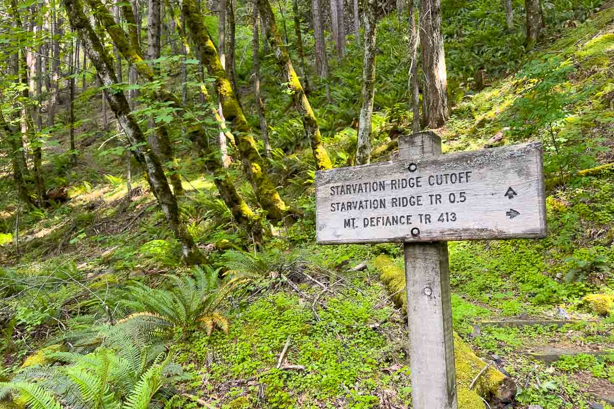
Trail #3: Mount Defiance Trail and Starvation Ridge Loop
Distance: 12.6 miles loop
Elevation Gain: 5,193 ft
Difficulty: Strenuous (really)
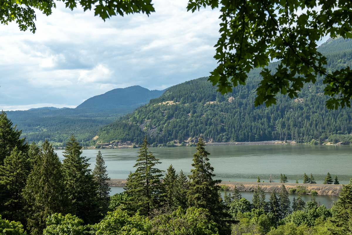
This is the challenge trail of the Gorge. The Mount Defiance Trail is one of the steepest in Oregon, climbing from near sea level to over 4,900 feet.
It’s a grueling grind with exposed ridgelines, potential snow near the top, and a final summit that includes some radio towers, which are easy enough to ignore because the views are wow!
On a clear day, you’ll see Mt. Hood, Mt. Adams, and the Gorge spread out like a panoramic photo.
Standing at the base of the ridge, it’s easy to see why hikers use it for training. It’s steep, remote-feeling, and absolutely not for beginners. If you’re considering it, come prepared: microspikes, poles, and a healthy respect for your quads.
READ MORE: 21 BEST Columbia River Gorge Hikes
Plan Your Visit
- Parking: Small paved lot with a few spots; fills quickly
- Bathrooms: Yes, at the trailhead
- Trailhead: All trails mentioned start here.
- Season: April–October for best trail conditions
- Dog-Friendly: Yes, leashed
- Trail Surfaces: Mix of paved, dirt, gravel, and steep climbs
- Fees: None
Final Thoughts: A Little Bit of Everything
Starvation Creek State Park is one of those rare spots where you can customize your adventure. Want an effortless waterfall fix?
You’ll get it in under two minutes. Craving a gentle bike ride or walk? You’ve got miles of paved trail. Ready to destroy your calves? Mount Defiance is right there waiting.
It’s an easy place to overlook on your way through the Gorge, but with so much packed into such a compact area, it’s absolutely worth a stop—whether you’re in it for the picnic table or the summit views.
More From Around The Gorge:
- 17+ Must-Visit Columbia River Gorge Waterfalls
- 17 Amazing Spots to Go Camping on The Columbia River Gorge
- Best Columbia River Gorge Hikes
- 17 Waterfalls Near Portland (#10 and #14 Are INSANE!)
- Multnomah Falls Hike: EVERYTHING You Need to Know
- Elowah and Upper McCord Creek Falls Trail
- Wahkeena Falls: 2 Trails to Choose From!
MORE ON THE WEST COAST:

READ MORE: The Best of Oregon
READ MORE: The Best of Washington
READ MORE: The Best of California
*GRAB THE BEST WEST COAST ADVENTURE MAP FOR YOUR NEXT TRIP!*