DON’T Visit Yosemite National Park Before Reading This!

Many visitors don’t make it as far as Glacier Point while exploring Yosemite National Park, but it’s worth the drive for the breathtaking views! This is one of the most epic areas of Yosemite but there are some things to know before you go!
Table of Contents
What is Glacier Point?
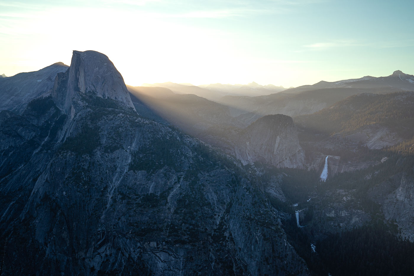
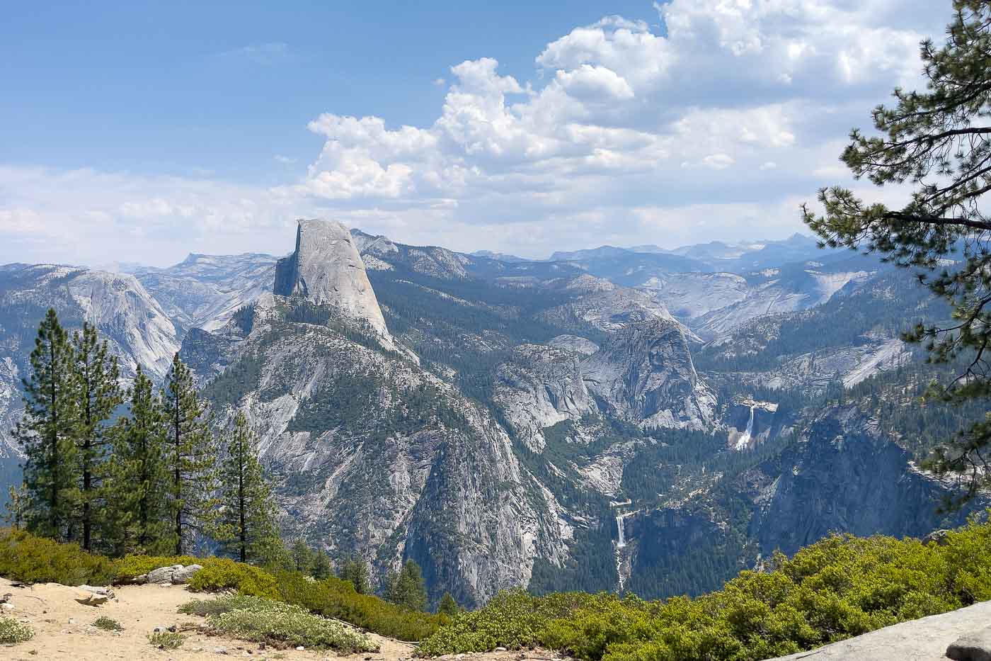
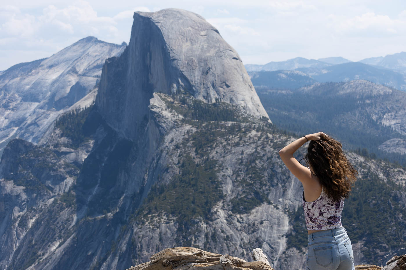
Glacier Point is a stunning overlook about 3,200 feet above the valley floor, offering iconic views of landmarks like Half Dome and Yosemite Falls.
It’s a must-visit spot for anyone looking to experience Yosemite’s natural beauty.
Getting to Glacier Point

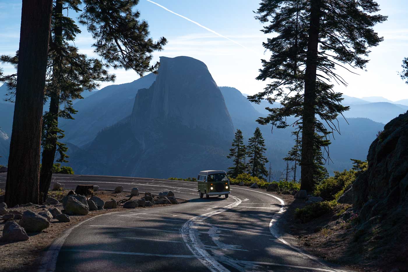
Located about an hour’s drive from Yosemite Valley, Glacier Point can be accessed via Northside Drive. Follow Wawona Road and turn left at the Chinquapin intersection.
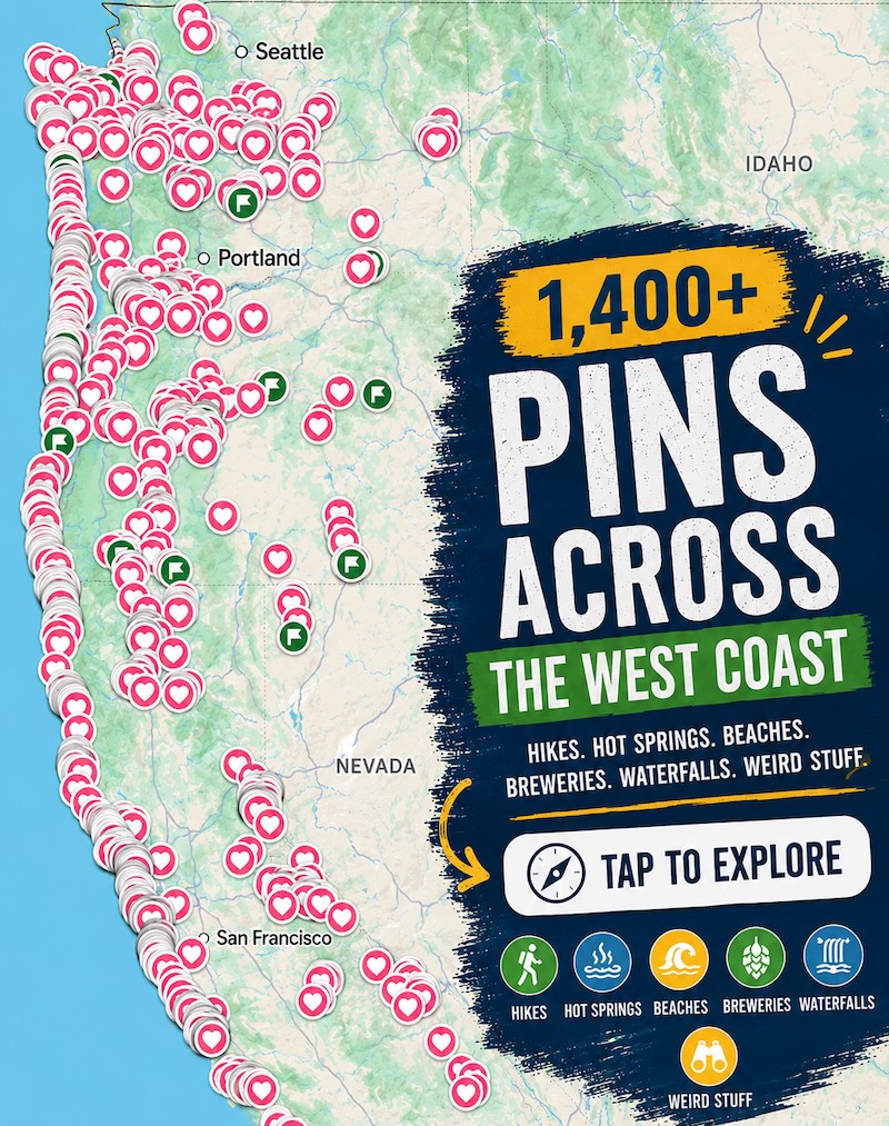
📍 GET THE ULTIMATE PNW MAP 🗺️
Get our curated list of the best adventures, things to do, and places to grab a brew loaded onto your maps with just two clicks!
✅ Waterfalls ✅ Hikes ✅ Viewpoints
✅ Craft breweries ✅ National Parks ✅ 1400+ Pins

Parking and Shuttle Options
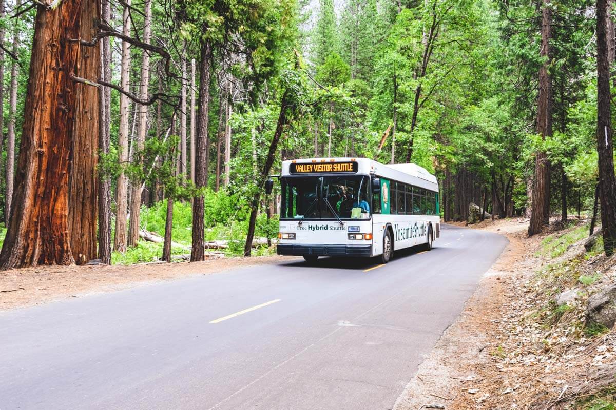
Parking fills up quickly in peak season. If the lot is full, you can use the free shuttle from the Yosemite Ski and Snowboard Area. Alternatively, consider taking a tour bus to reach the area.
*GRAB THE BEST WEST COAST ADVENTURE MAP FOR YOUR NEXT TRIP!*
Glacier Point Road Seasons
Access to Glacier Point is seasonal, typically closing in November and reopening in late May or early summer. Check the current conditions for updates.
Sentinel Dome Trail

Distance: 2.2 miles | Difficulty: Moderate | Elevation Gain: 459 feet
This hike offers stunning 360-degree views, showcasing Half Dome, Yosemite Falls, and more.
Taft Point Trail
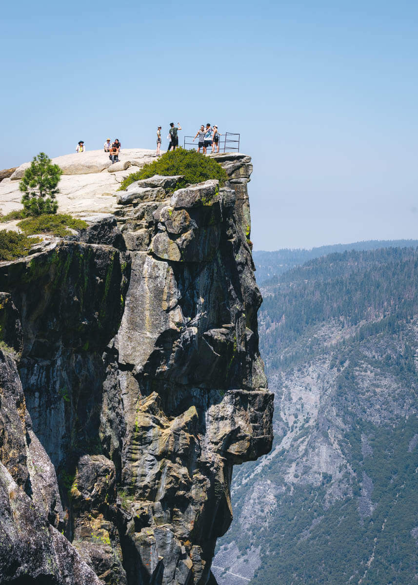
Distance: 2.3 miles | Difficulty: Easy | Elevation Gain: 354 feet
This trail leads to a thrilling overlook with views of deep fissures and the valley below.
Glacier Point
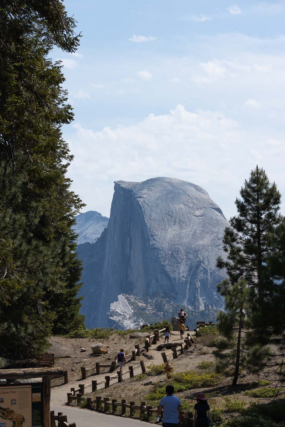
This is the main attraction! Glacier Point offers unparalleled views of Half Dome and Yosemite Falls.
Washburn Point
Another must-stop, Washburn Point offers sweeping views of the valley and is easily accessible.
Tips for Driving Glacier Point Road

- Long Drive: Expect about an hour’s drive from the valley, with winding roads that may cause motion sickness.
- Extensive Road: Glacier Point Road stretches for 17 miles after the turn-off, with many attractions along the way.
- RV Restrictions: Large RVs are not allowed; consider using the shuttle service instead.
- Seasonal Access: The road usually closes in November due to snow and reopens in late spring or early summer.
- Prepare Supplies: Bring food, water, and ensure your gas tank is full as there are few facilities.
- No Cell Service: Download maps and gather necessary info before your trip, as cell service is limited.
FULL GUIDE: Glacier Point Road: What to Know
Final Thoughts
Glacier Point offers some of the best views in Yosemite and is well worth the drive. The area is not only stunning but also features great hiking opportunities. Plan for a day visit to take in all the sights!
- Things To Do in Yosemite: 26 Can’t-Miss Spots!
- 15 Best Hikes in Yosemite National Park
- Sentinel Dome and Taft Point Loop Hike
- Vernal Falls Hike—3 Ways to Hike Up!
- Where to Stay in Yosemite: BEST Areas, Camping and Lodging
- Waterfalls in Yosemite National Park: 8 BEST!
- Glacier Point Road: What to Know
We hope this helped you plan your visit to Glacier Point in Yosemite!
*GRAB THE BEST WEST COAST ADVENTURE MAP FOR YOUR NEXT TRIP!*
MORE ON THE WEST COAST:

READ MORE: The Best of Oregon
READ MORE: The Best of Washington
READ MORE: The Best of California
*GRAB THE BEST WEST COAST ADVENTURE MAP FOR YOUR NEXT TRIP!*